A year without travel has sharpened my wanderlust like never before. But through a challenging year, it’s also been natural to take comfort in familiarity.
While my bucket list is always growing longer, lately I’ve found myself fondly reflecting on some favourite destinations that I’d love to revisit. Chief among those is the American Southwest.
A few years ago, I did what any enterprising adventurer would do: I turned 25 and promptly rented a car, free from the shackles of youth insurance premiums. I’d been feeling the pull of the Southwest for some time, and I decided to treat myself to a solo desert drive for three weeks.
I’ve taken no fewer than six separate multi-week road trips through parts of the US as an adult. For this one, I travelled to the “Grand Circle” region: the Grand Canyon in northern Arizona, five national parks in Utah, and everything in between.
In This Post
- Trip Overview
- Death Valley
- Sedona
- Grand Canyon
- Navajo Tribal Lands
- Moab
- Scenic Byway 12
- Zion
- Conclusion
Trip Overview
Hiking the Grand Canyon was my main motivation for this trip. I made sure to secure my overnight backcountry permit several months in advance.
With that as the centrepiece, I built the rest of my schedule. I mostly planned day hikes and landscape photography, with camping accommodations the whole way.
Las Vegas was my access point: cheap WestJet cash fares from Vancouver, and no need to muck around with a one-way car rental.
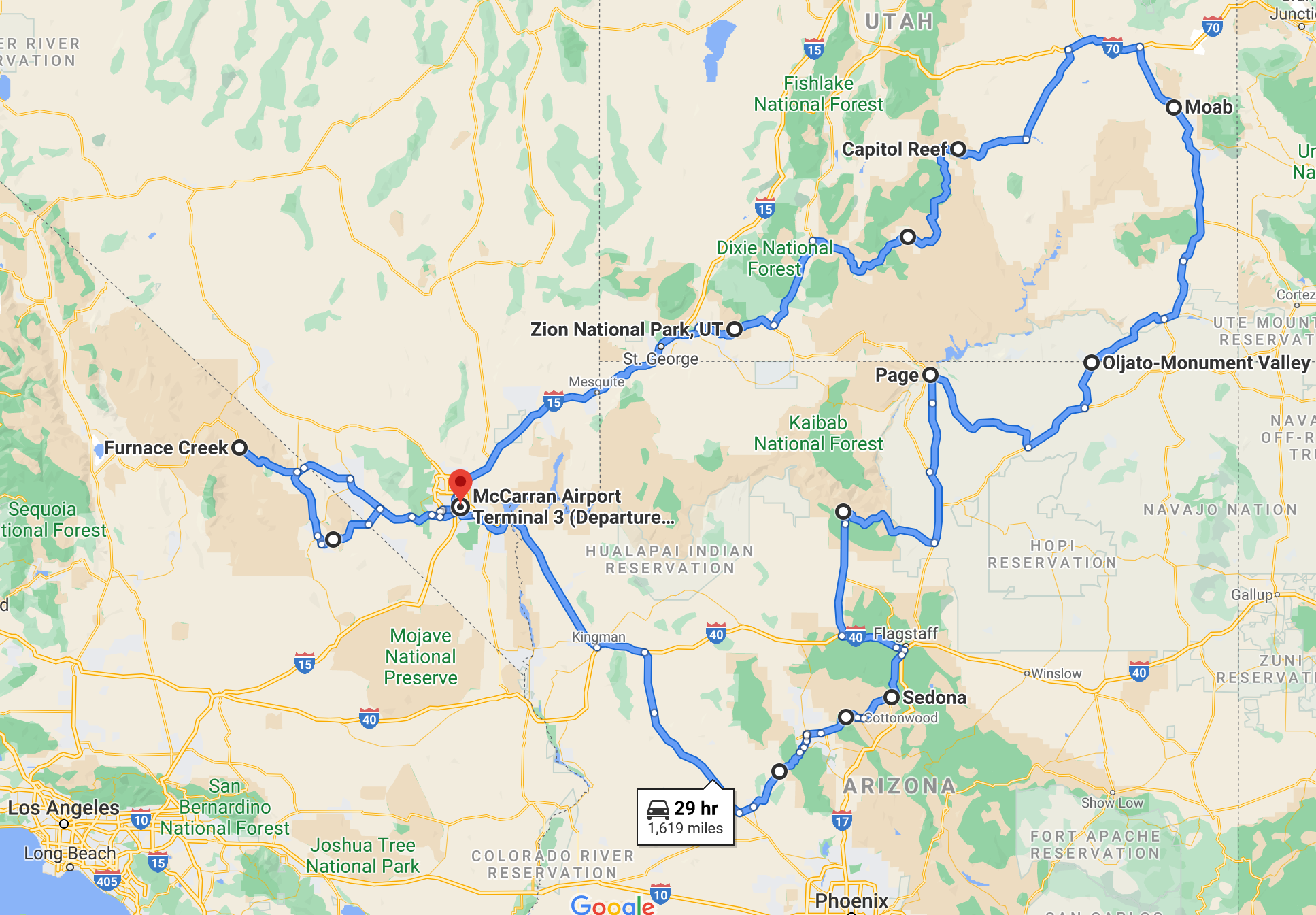
Overall, I was extremely pleased with the pace and itinerary of my trip:
- Death Valley: 2 nights
- Sedona: 3 nights
- Grand Canyon: 4 nights (1 at the rim, 2 at the river, 1 at the rim)
- Page: 1 night
- Monument Valley: 1 night
- Moab: 4 nights
- Capitol Reef: 1 night
- Bryce Canyon: 1 night
- Zion: 3 nights
Death Valley: 2 Nights
After landing at McCarran International Airport, I picked up my rental car and got out of town right away (but not before a mandatory pit stop at In-n-Out Burger). I began my journey with a quick detour west, into the Basin and Range Province.
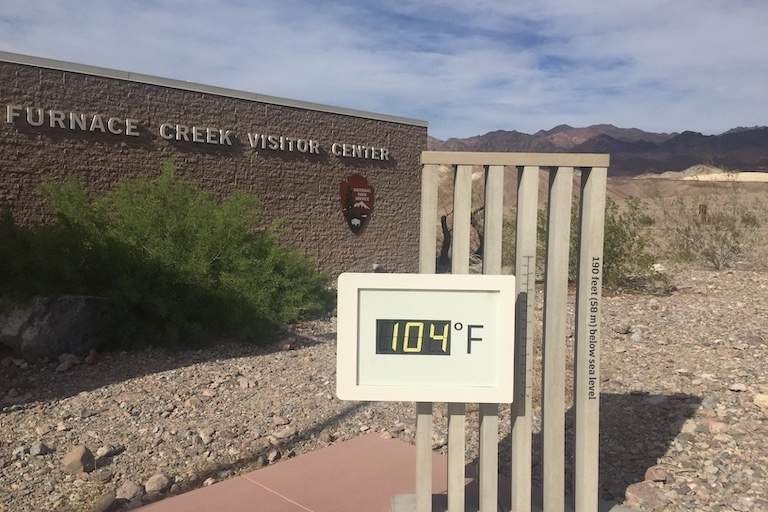
Death Valley is known for having the hottest air temperature ever recorded. It didn’t disappoint as I arrived to 104-degree weather (40 degrees Celsius), on an April afternoon.
I took it reasonably easy the first day, pitching my tent at the aptly-named Furnace Creek Campground. I snuck in an easy evening hike at Golden Canyon, hoping to minimize my time exerting during the heat of the day.
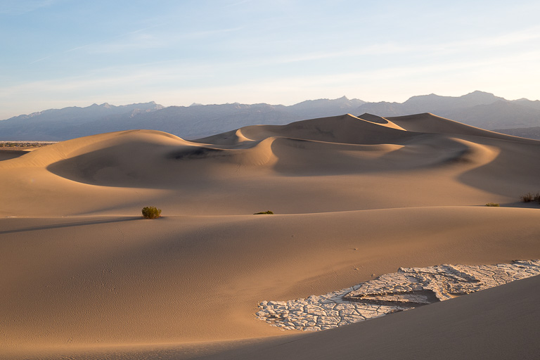
Later, I explored the Mesquite Sand Dunes under the full moon, and went back at dawn the next morning. There’s nothing quite like a pristine sand dune groomed for hours overnight by the wind, only disturbed by sparse animal tracks from unseen desert critters.
On my one full day in the park, I checked out Badwater Basin (the lowest point in North America), Dante’s View, Artist’s Drive, and some random remnants of the borax mines from frontier times.
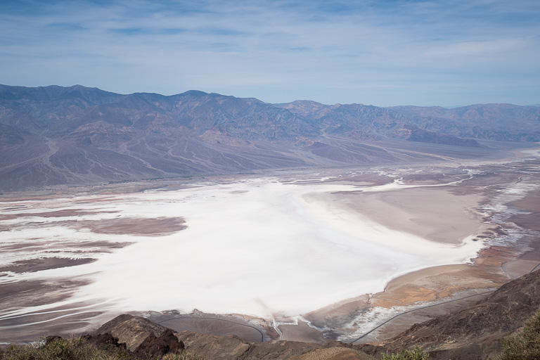
Due to time constraints, I missed out on Racetrack Playa and Telescope Peak. Still, it was a nice gentle entry into my trip.
The following morning, I caught sunrise from Zabriskie Point, before taking a mountainous scenic route (Old Spanish Trail) on a whim back to Las Vegas.

I found Death Valley not to be a place of desolation – rather, it’s a place of dramatic adaptation of life, and a great introduction to the desert in that sense. What struck me was the silence, without the background noise of trickling streams, gusts of wind, or human development.
Sedona: 3 Nights
I spent about two hours in Las Vegas, for lunch and a token stroll along the Strip, before it was time to hit the road. This was my longest day behind the wheel.
I chose the scenic route to Sedona. Avoiding the Interstate as much as possible, I took US-93 towards Phoenix before veering back north on AZ-89. I camped near Prescott for the night, positioning myself for a full two and a half days seeing the best of Sedona.
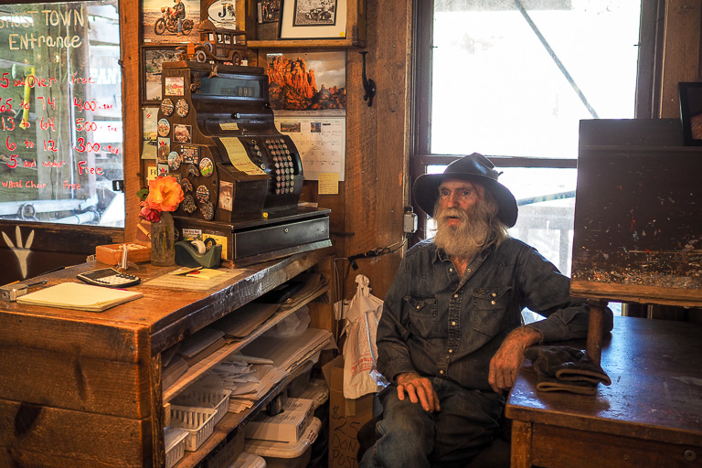
From there, I followed AZ-89A through the forest to Jerome, a cute little town built into the red rock cliffs. I checked out the local ghost town, which no Southwest trip would be complete without.
Descending into the Sedona valley, it was clear I’d made the right choice for my scenic approach. The whole way into town, the red rock formations were unmistakable, with different colours of sediment peeled back by eons of erosion.
First, I got my bearings at the visitor’s centre to the south. I made sure to explore different corners of town for activities and meals throughout my stay, as the area is divided into a few valleys shooting off from the “downtown” core.
Sedona has something that could appeal to just about anyone, offering a unique balance of quality adventure and quality relaxation alike. This trip, I erred heavily on the side of adventure.
I hiked Bear Mountain, Boynton Canyon, Courthouse Loop, Cathedral Rock, and the West Fork at Oak Creek Canyon. I also took in sunset views at Airport Mesa and Red Rock Crossing.
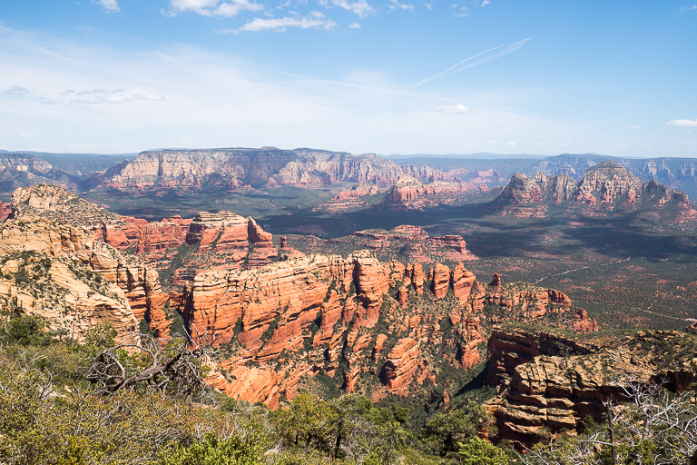
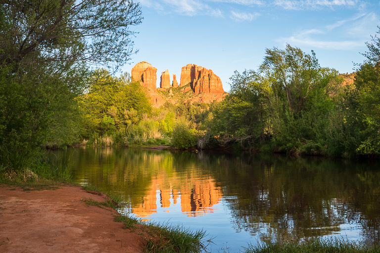
Each was quite distinct and quintessentially captured Sedona. I particularly enjoyed the West Fork Trail – a unique route with gentle elevation gain and temperate conditions, numerous shallow stream crossings, and a cozy immersion in red rock.
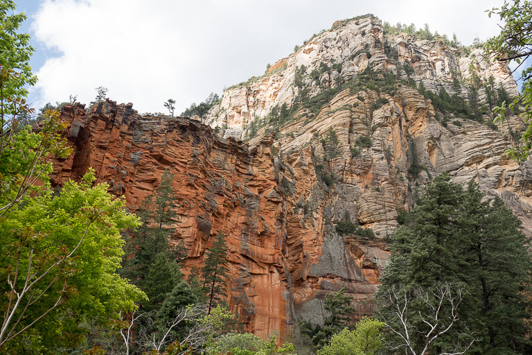
Next time, I’d look into a jeep tour through some of the more remote areas, and probably also carve out a bit more time for tranquility and to poke around the vibrant local art scene.
Grand Canyon: 4 Nights
I grabbed lunch and backcountry supplies in Flagstaff before setting off for the Grand Canyon. On the highway, naturally I got stuck tailgating an 18-wheeler in a blizzard. In Arizona. In April.
The Grand Canyon rim is part of the Colorado Plateau, sitting at over 7,000 feet above sea level. Indeed, the canyon wouldn’t be so deep if not for such extreme geological uplift millions of years ago. The crown jewel of the region is truly a paragon of the dramatic natural forces at play – not just geology, but also bizarre weather patterns (which sadly made photography a bit challenging).
My stay was based in Grand Canyon Village, the epicentre of the national park’s South Rim. There are also park facilities at the North Rim, a summer-only destination at higher elevation, but a 5-hour drive away as there are no roads crossing the canyon until it narrows up-river.
I went straight to the geology museum to get my bearings, and I’m glad I did, as it would put into context everything I was about to experience over the next few days.
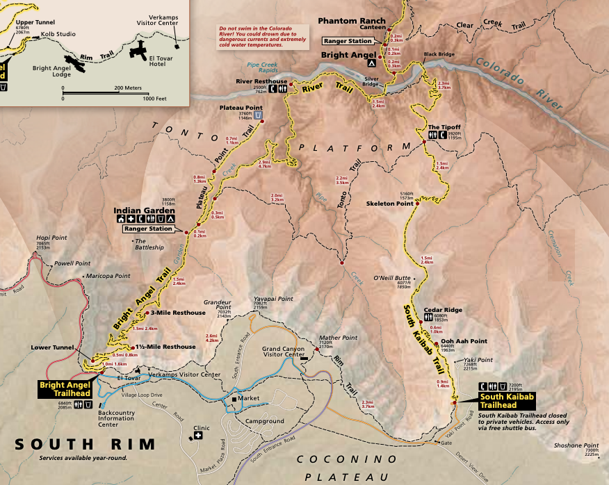
As a first-time visitor and solo hiker, I planned the basic backcountry itinerary. The “corridor” is the main part of the canyon: deepest, widest, and most accessible. I’d lined up two nights at the river, hiking down the exposed trail with no water sources and hiking up the sheltered trail with water.
I spent one night at the developed campground in the village, all set for my backcountry expedition. At the crack of dawn, I took the park’s shuttle bus to Yaki Point and set off down the South Kaibab Trail.
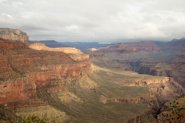
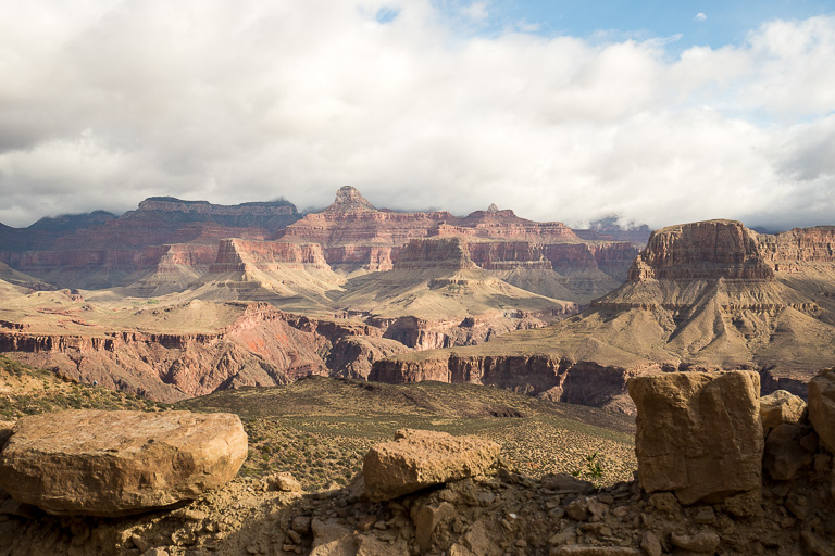
They say you haven’t really experienced the Grand Canyon until you’ve been in the Grand Canyon, and I couldn’t agree more. It’s about seven miles to the river with a vertical mile of elevation change, but you barely have to go a few hundred feet before you’re surrounded by splendour.
About a mile down the trail, I hit a point where the trail went from hugging the canyon wall, to being exposed on a ridge jutting into the canyon. It was undeniable: I was in it. The lingering clouds from the previous day’s storm cleared, the sun was properly up, and I slowed down to “photography pace” – I gave up on making good time because I just couldn’t stop whipping out the camera.
The trail levelled off at the Tonto Platform, a lush midsection with an extensive network of trails for exploring the canyon lengthwise. I was already getting ideas for my next visit!
I forged on towards the river. There’s a second inner canyon here, where the cliffs drop off again. The inner canyon’s walls are so steep relative to its width, you can’t even see that part of the river from the village.
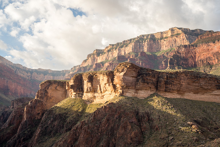
All the while, I was thinking about the displays at the geology museum. I followed the changing sedimentary deposits and other rock intrusions as I hiked down into the canyon, with each layer revealing a different era of Earth’s natural history. Some of the exposed rock was formed over a billion years ago. I wasn’t just hiking through space, I was hiking through time.
Finally I arrived at the peacefully powerful Colorado River, a world away from home. Just a short hop further and I was at my campsite along the more sheltered Bright Angel Creek.
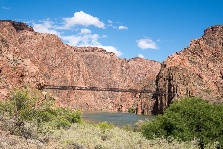
I broke a tent pole but settled in for an otherwise serene two days. Much closer to sea level, I enjoyed spring weather with daytime highs in the high teens (Celsius). White-tailed deer strolled through my campsite as I read and took in quirky foliage that resembled a Dr. Seuss universe.
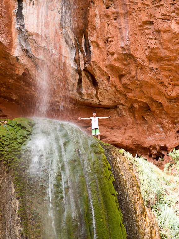
For my full day in the canyon, I left my heavy gear at camp and day-hiked to Rainbow Falls. It was mostly overcast, but I was happy to take some time to soak in the distinct features of the inner canyon.
I snacked on energy-efficient light bites for breakfast and lunch, as I tend to do in the backcountry. For my dinners, I cooked one night at my campsite, but the other night I booked a meal at Phantom Ranch. A short walk from the tent sites, the lodge’s beds get booked a year in advance, but the dining hall has plentiful space for campers to share a hearty meal with travellers from all over the world.
On my final morning, I broke camp before dawn, not wanting to get caught doing a vertical mile of elevation gain in the hot Arizona sun. I hiked up the well-travelled Bright Angel Trail, which has a man-made water pipeline.
Once I cleared Indian Garden (a campground at the Tonto Platform which would make for a good halfway overnight if you’re unable to hike out the whole way in one shot), the trail followed a partially-shaded side canyon the rest of the way. It lacked the sweeping vistas of South Kaibab, but it made for a much better trek with a heavy pack. I was very glad to experience both.
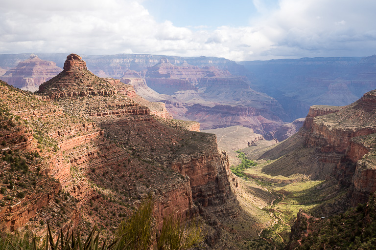
Powering my way back to 7,000 feet, I emerged from the canyon into – you guessed it – another blizzard. I got myself a proper pizza and beer, reset back at the developed campground (including a much-needed shower and load of laundry), and poked around the South Rim’s many viewpoints for sunset.
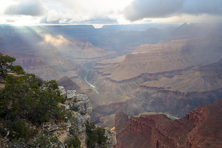
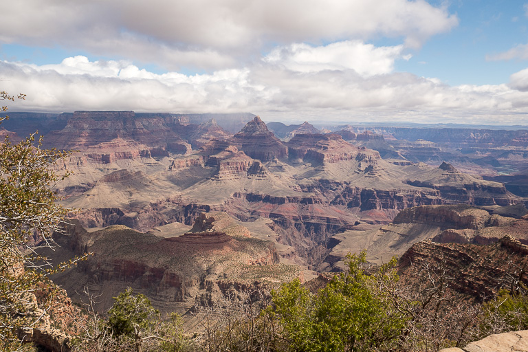
Still glowing, I spent the next morning leisurely taking in the viewpoints along Desert View Drive, as I departed the village eastward bound.
Navajo Tribal Lands: 2 Nights
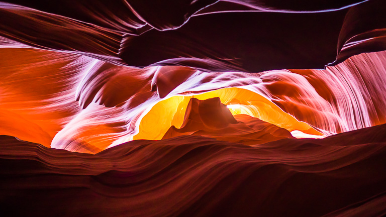
Next stop was the town of Page, with a few iconic attractions. First was Antelope Canyon, a picturesque slot canyon carved by water, wind, and sand.
The canyon is on the Navajo Nation’s tribal land, and you can only visit with a guided tour (there are countless tour providers in town). It felt a bit like we were shepherded through, constantly trying to dodge other tour groups while we all competed for the same photographs.
I’m sure a dedicated photography tour would have been more satisfying, or a tour to a less-visited part of the canyon, but somehow I ended up with some very cool abstract shots.
The next morning, I did a quick tour of the Glen Canyon Dam. It provides an immense amount of clean power to the region. It’s also the catalyst for Lake Powell, a destination for water recreation ranging from boozy houseboat rentals to wilderness kayaking. For another time I suppose.
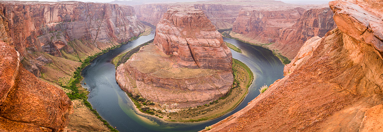
I also saw Horseshoe Bend – a classic, but extremely crowded, and quite tricky to get a good photo safely.
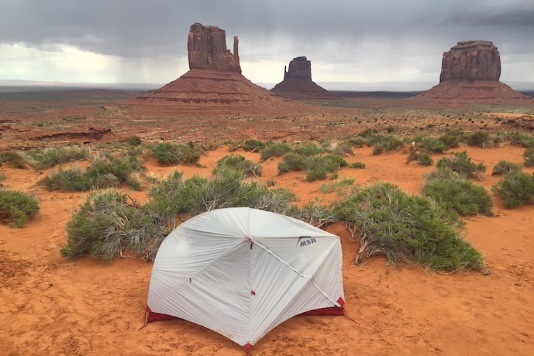
After that, I set off for a night at Monument Valley. The campground is situated with a perfect view of the inimitable Mittens.
I also did a tour there, which took me through some sacred tribal rocks and archeological sites that aren’t open to the self-driving public. Overall I found it to be a much more intimate cultural experience than Antelope Canyon.
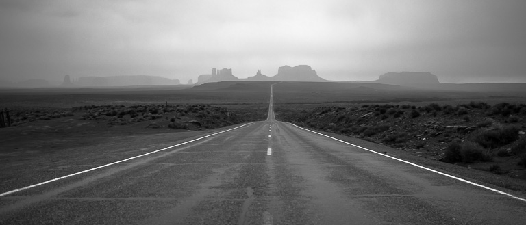
The next morning, I set off north, but not without a glance back down the famous Forrest Gump highway.
Moab: 4 Nights
My next major stop was Moab, a true outdoor adventure mecca. I mostly hiked, but it’s known as a mountain biker’s paradise, and there are also river rafting experiences for all skill levels.
The region is bisected by a few rivers, and access to some of the more ambitious trailheads isn’t always straightforward. Notably, Canyonlands National Park is cleaved into three parts, each one more remote than the last.
Island in the Sky is the primary destination, with drive-up viewpoints on a sheer plateau overlooking the other parts of the park.
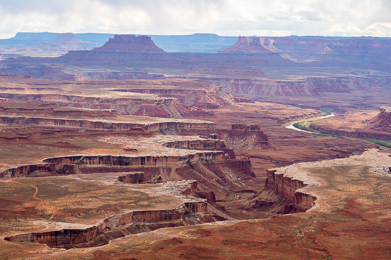
With Moab as my home base, I teed off between the nearby Islands in the Sky district of Canyonlands, and Arches National Park. I planned one morning and one afternoon at each, catching each park’s best attractions at the optimal time of day, with a lunch break in town in between.
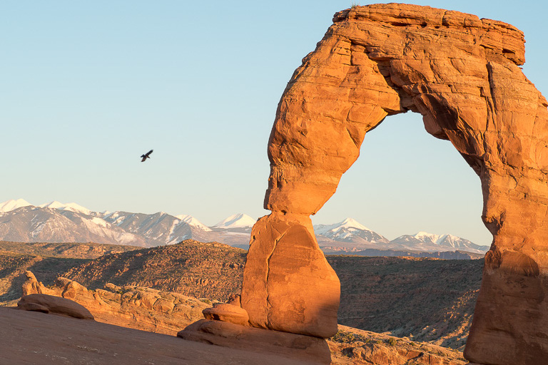
Among the sights at Arches, I took in the fragile Landscape Arch, and the picturesque Delicate Arch. (Allegedly the paperwork got mixed up decades ago.)

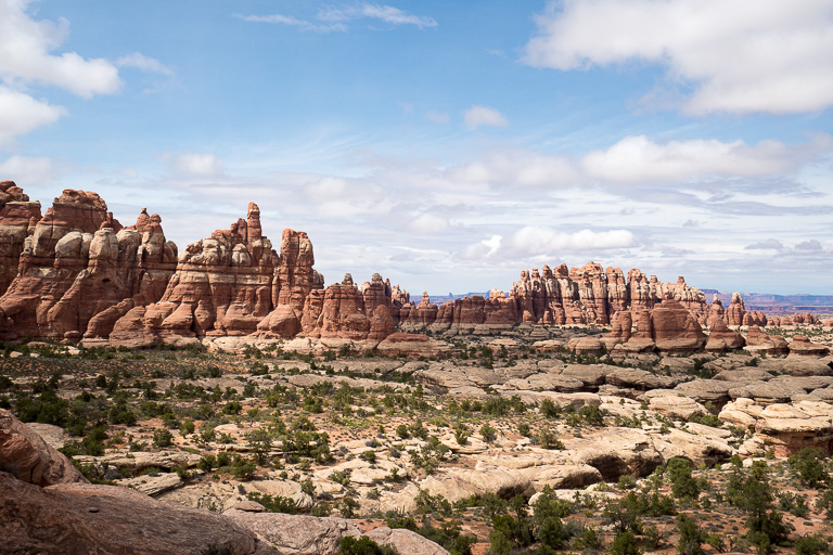
But first, I was particularly keen to explore the Needles District. Logistically, it fit nicely as a full-day hike en route to Moab.
The area is predominantly developed for ATV-access camping, but there’s still a good trail network for foot traffic. I explored the veritable Martian landscape for some of the most satisfying (and dehydrating) hiking of the trip.
(The Maze, the most rugged of the park’s three sections, has almost no development and can’t easily be reached from Moab.)
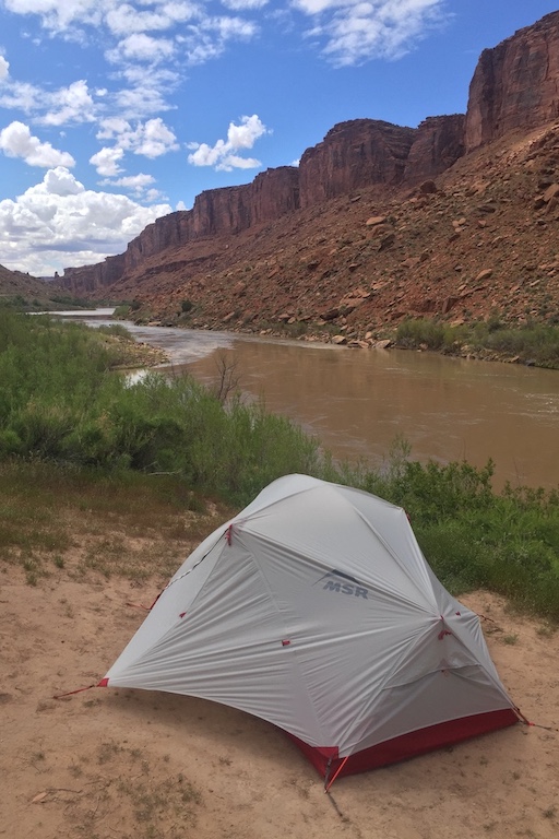
I then rolled into town and scoped out a campsite. There are tons of first-come-first-served spots along the Colorado River in both directions from Moab, but they’re extremely popular. You have to be there first thing in the morning to snag one, or make friends with someone leaving the next day. 😉
Even being located as centrally as possible, I was still sleeping a good hour’s drive away from everything. One morning, I was up at 4am to catch sunrise at Mesa Arch, jockeying for position with all the other under-caffeinated photographers.
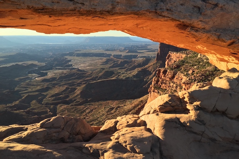
Later that same day, I ended up at Delicate Arch for sunset, jockeying for position with all the proper tourists. I don’t remember the last time I’d seen a popular site so stereotypically crowded.
But as dusk fell and the crowds thinned, the only ones left were a few other photographers whom I recognized from my early morning excursion. I’d been hoping to try some night sky photography at some point on my trip, and the folks who remained after nightfall were specifically there to shoot the Milky Way.
I figured this was as good a time as any. I stuck around, picking up advice from a National Geographic-published artist as we kept each others’ sleep-deprived spirits up in the darkness, fiddling with our camera settings and awaiting the perfect celestial conditions.
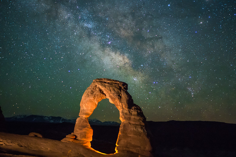
Excited but running on fumes, I called it a night around 2:30am. I still had to hike back to the car and drive back to my campsite. By that point I’d been up for 24 hours.
I awoke four hours later to an inhospitable tinderbox of a tent. I immediately scrapped all of my low-priority plans for the day, booked a Class I river rafting tour, and took a nap afloat on the refreshing waters of the Colorado River.
To cap off my time in Moab, I checked out the local brewery. The place was packed – Moab’s a small town, and I guess this was the go-to après-bike watering hole. Utah’s Mormon legacy has left the state with some asinine liquor laws, but I was very impressed with the quality of beers and range of styles that they were able to brew while staying under 4% ABV.
Scenic Byway 12: 2 Nights
After catching sunrise at Dead Horse Point on my way out of Moab, I had a lot of roadside sights to see and not enough time. My next stop was Capitol Reef National Park, with the intention to camp somewhere near the town of Torrey.
I decided to skip Goblin Valley, which struck me as more of a photo op (of which I’d had many lately). Instead, I opted for Little Wild Horse Canyon, to get my legs moving again after a lazy day, and for a taste of a slot canyon with a more exploratory vibe than Antelope Canyon.
I spent the late afternoon checking out the main part of Capitol Reef, with a short hike and some sunset views.
As the least-visited of Utah’s five national parks, I was surprised to find Capitol Reef’s first-come-first-served campground was completely full. For the first and only time, I was without a place to sleep!
I’d researched the laws for camping on public lands, knowing I might need a backup plan. But at 10,000 feet with the wind howling and the temperature hovering just above freezing, I had no desire to pitch my tent. I found a forest service road just off the highway and slept in the car.
I’m very glad this happened at a point in my trip where I could afford to have a poor night’s sleep, and not when I was gearing up or winding down from a demanding backcountry journey. Regardless, I’m not eager to repeat that experience.
Onwards I trudged along Scenic Byway 12, which gets its name for good reason. After breakfast in the town of Boulder, I drove the Burr Trail into the backside of Capitol Reef.
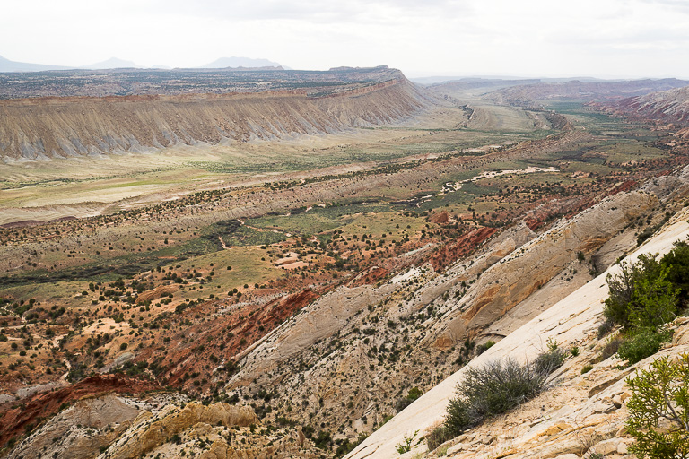
The drive itself was quite beautiful, but the real prize was the view from Strike Valley Overlook. I can’t think of another vista that highlights the dramatic wrenching of the landscape so well.
Just looking at the terrain, I could tell that there’s a whole world of hidden gems to discover in the area.
Back on the main road, I drove the breathtaking Hogback section of the highway, a rolling knife-edge ridge with drop-offs into the red rock landscape on either side. The whole area is loaded with sights, but I’d say it’s worth a detour off the Interstate just to drive that stretch of road.
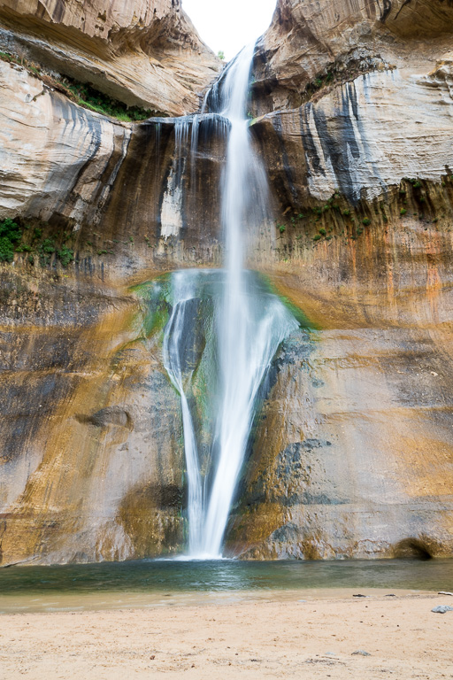
I cooled off with an afternoon forest hike to Lower Calf Creek Falls.
Then, I was off to Bryce Canyon National Park for a night. I took in some viewpoints for sunset and sunrise. My favourite was Inspiration Point, with a perspective on the canyon that made the weathered rock hoodoos look like terracotta warriors in formation.
Without ambitious plans for Bryce, I went for a brief morning hike through the natural amphitheatre before setting off for my final destination.
Zion: 3 Nights
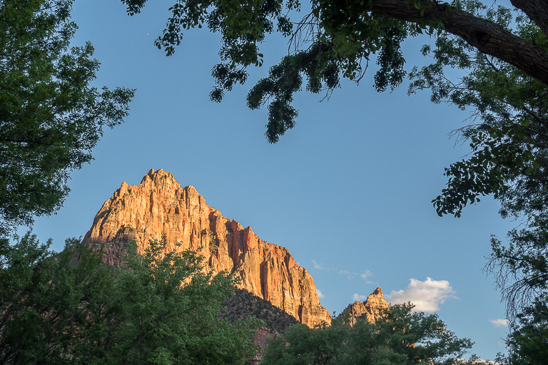
Zion National Park has two premier attractions: the Narrows and Angel’s Landing.
The Narrows is a hike that takes you up the river, in the river. Wetsuit rentals are available from several outfitters. Unfortunately, spring run-off from snowmelt in the mountains was quite heavy, and the river was flowing too strong to hike while I was there.
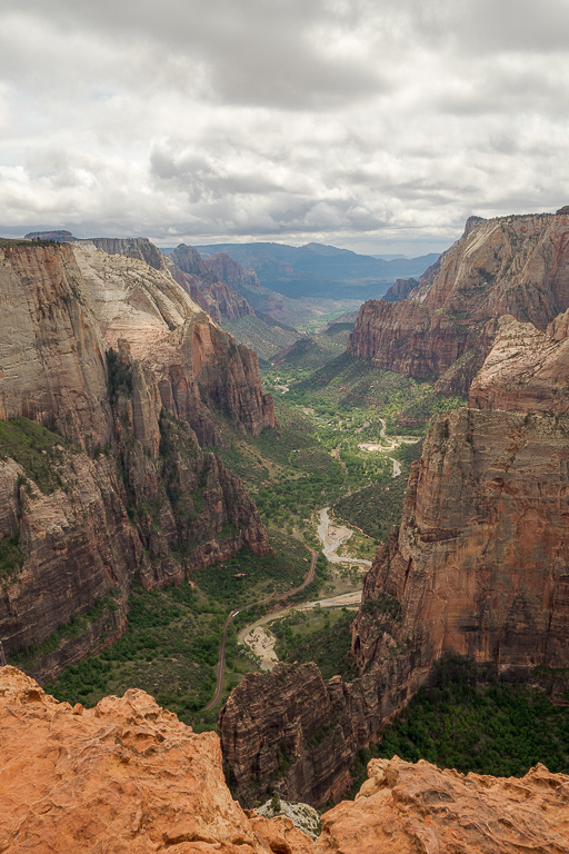
As a safe backup plan, I hiked to Observation Point for sweeping canyon views.
I also planned to do Angel’s Landing, a hike along a knife-edge fin jutting out into the canyon. It’s an iconic accomplishment and I figured it would be the perfect achievement for the final day of my trip.
To get to Angel’s Landing, you have to take a shuttle bus (in peak season) to the trailhead. Then, you have to traverse relentless switchbacks before you even get to the dangerous part.
A bit about me: I’m not great with heights. More specifically, I’m not great with exposure to falling. I absolutely had to do this hike, but I wasn’t keen on navigating hordes of people passing each other awkwardly on a rope-assisted slickrock trail.
That meant making sure I was on the first shuttle bus in the morning, with a plan to crush the switchbacks as fast as possible. Luckily I’d been keeping in great shape the previous three weeks.
I was the third person at the summit that day, took a moment to enjoy, and scurried off before the masses clogged my return route.
Winding down, I spent some time checking out some lower-impact sights, including the Emerald Pools and a number of photogenic viewpoints of the canyon’s rock formations.
In the gateway town of Springdale, I popped into a sports bar to watch some playoff hockey. I was visiting right on the cusp of Las Vegas being awarded an NHL franchise. I arrived as a stubborn gatekeeping Canadian, adamant that hockey wouldn’t work in the desert and annoyed that the league was expanding to an odd number of teams. But I ended up having a fantastic chat with the bartender, a lifelong Utahn who was ecstatic to finally have a home team to root for.
Overall, Zion’s a great park, rightfully deserving of its popularity. It’s got a lot of accessible highlights and beauty, with real Garden of Eden vibes that can hide its sense of adventure underneath. It was the perfect spot to wrap up an awesome trip.
Conclusion
As with all travel, my first trip to the American Southwest was an exercise in flexibility. At its worst, I was adapting to adverse weather and sleeping conditions. At its best, I jumped on spontaneous opportunities and changed my plans for the better.
Through it all, while I wouldn’t change a thing, it’s only left me with more reasons to go back! As I begin to think about potential trips stateside, I’m feeling the allure of a return to the desert.
I do think that US travel will be back on the table before going global. And even though city life has mostly returned to normal by all accounts, I can’t think of a better way to cap off a distanced year than by embracing the great outdoors.
Stay tuned for a future post, in which I’ll go over trip planning strategies and advice for trips inspired by mine, as well as some general impressions from my experience.









Thanks for sharing Josh, really looking forward to hit the road again
Thanks for a great article Josh! My wife and I are renting an RV (for the first time in our lives) in Chicago travelling along Route 66 to LA, with side trips to Sedona, Grand Canyon, Page, Bryce, Zion and Vegas before returning to the mother road. We are doing this for the full month of October. So your “looking back” essay was another source of information for us to consider.
I’ve heard RV travel is a different beast. I’m sure you’ll have a blast!